San Francisco's Changing Shoreline
Gold Rush!
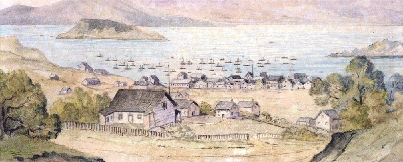
The discovery of gold at Coloma in 1848 brought people from all over the world into California. Most of them arrived by ship to San Francisco. Passengers and crew alike abandoned ship, as the new miners went inland towards the gold fields east of Sacramento. Some abandoned ships were docked and used as stores, like the Niantic, now beneath the Transamerica Building. Other ships became raw material—part of the debris and fill used to extend San Francisco’s shoreline.
San Francisco’s Changing Geography
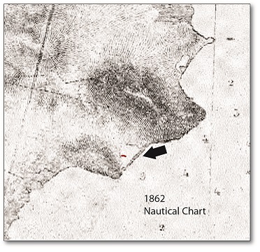
The first nautical chart of the San Francisco Bay was published in 1862. The arrow points to the cove area where archaeologists found the remnants of the scow schooner and barge near what we now call Candlestick Point.
Urban Sprawl and Shipyards
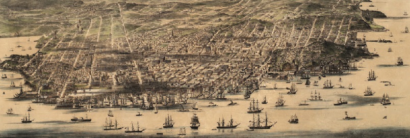
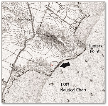
San Francisco's population grew from a few hundred in 1848 to more than 25,000 within a decade. By 1883, more buildings appeared on coastal survey maps. Hunters Point became home to many shipyards, where new ships were built and old ones repaired. By 1893, maps showed urban sprawl moving southward. Warehouses appeared along the coastline. In the area where the two ships were found, a business known as the Johnson and Brown Dairy had a dock next to the cove.
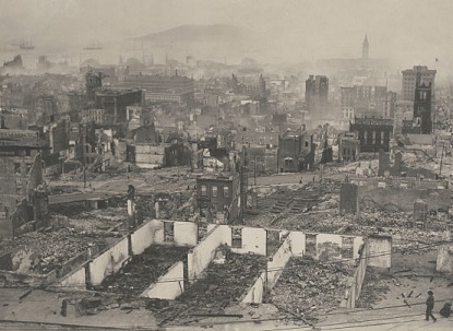
The 1906 Earthquake
On April 18, 1906, a 7.9-magnitude earthquake hit San Francisco, destroying nearly 80% of the city and killing over 3,000 people. Much of the rubble from the earthquake was pushed into the bay, creating new land for San Francisco.
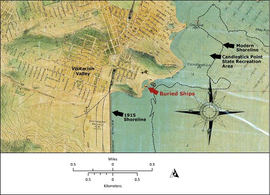
By 1915, more and more roads and buildings had appeared in the area of the cove south of Candlestick Point. The Southern Pacific Railroad yard and tracks were built on a filled-in area. Part of the cove where archaeologists would later find two ships was also beginning to be filled in.
Abandoned Ships, Salvage, and World War II Residences
In the 1920s and 1930s the railroads and trucks replaced ships for delivering cargo around the bay and San Francisco’s shoreline once again began to collect abandoned vessels. These ships, like the two found in 2011, were stripped of valuable material and then sunk to become landfill.
Why was more land needed? World War II brought more activity and people to the area. Workers at Hunters Point Shipyard and the Southern Pacific Railroad Yard needed residences nearby. Nearly 120 apartment- style buildings, called the “Candlestick Cove War Dwellings” were built in the area south of what is now Candlestick Park.
Construction of a Stadium and Highway
The shoreline south of Candlestick Point continued to change as the area developed. Construction of Candlestick Park began in the late 1950s, and the park opened on April 12, 1960. The parking lot for the stadium is built entirely on rubble and fill. Many buildings in the area were demolished during construction of US 101, its off-ramps, and Harney Way.
History Beneath a Utility Yard and Parking Lot
By 1980, all of the World War II era, Candlestick Cove apartments had been demolished. The newly built San Francisco Executive Park office building needed a parking lot, and the area closer to the water became a utility yard. Land beneath this utility yard was used to place sewer lines, burying an interesting part of the archaeological record and clues to San Francisco’s past that would be uncovered 31 years later.
And the Future?
More land reclaimed from the bay means more land to build on. Yet recent earthquakes in San Francisco and Japan have shown the potential dangers. Fill created in the late-nineteenth and early-twentieth centuries is prone to failure during earthquakes. Modern methods can re-engineer and re-compact what is now historic-era fill, reducing the risk. Modern upgrades to infrastructure such as sewer lines, expanded to serve a still-growing population, can also help to prepare the city for the future.